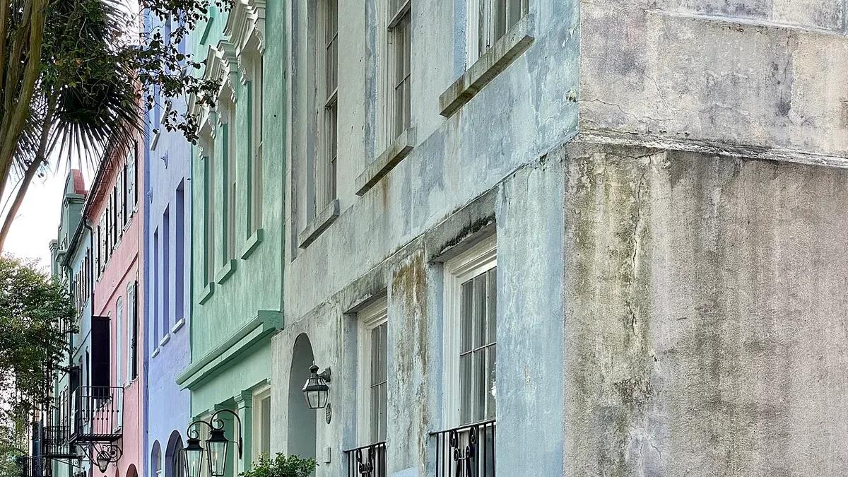
Colorful houses of Rainbow Row along East Bay Street in Charleston
Hotels70

Book soon

Last-minute hotels in Charleston

If the peninsula is full, look at Upper King, Mount Pleasant or the airport area. Pick whichever is closest to where you need to be in the morning.

from $89/night692 hotels compared

We compare hotels from top providers

/logo/skyscanner.svg logo/logo/kayak.svg logo/logo/trip.com.svg logo/logo/hotelscombined.svg logo/logo/booking.com.svg logo

About Charleston

Charleston’s historic peninsula sits between the Ashley and Cooper rivers. Stay near the City Market or King Street and the old streets, restaurants and harbor are all on foot. Cross a bridge for beach days and bigger hotels.

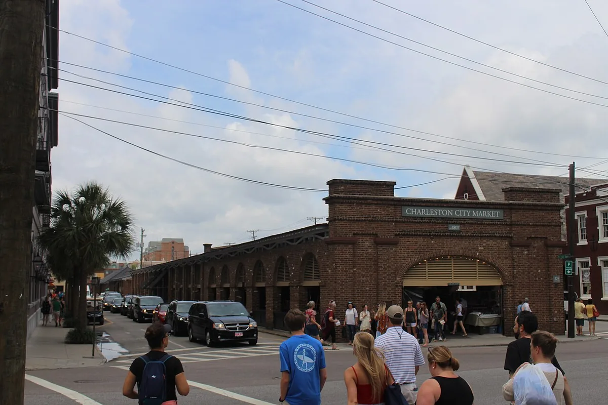
The City Market and French Quarter sit close to Waterfront Park and the Fort Sumter ferry departure at Liberty Square. Walk south past Rainbow Row to the Battery and White Point Garden. The blocks are short, but summer heat and cobblestones wear you down over a long day of walking.

King Street changes as it runs north. The shops near the historic core give way to the restaurants and bars of Upper King. Hotels around Marion Square and the Visitor Center are farther from the harbor but closer to dinner and the downtown buses.

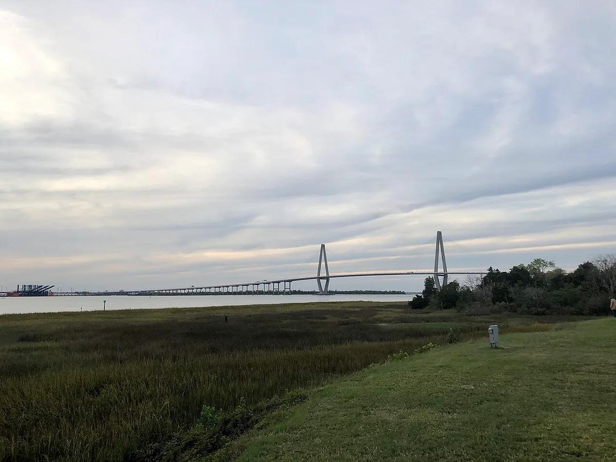
Mount Pleasant is across the Ravenel Bridge, with the Shem Creek restaurants and Patriots Point. Stay there with a car if the beaches are on the list. The bridge cuts it off from the peninsula’s walking routes. West Ashley, across the Ashley River, is the other place to stay if you are driving.

Summer here is sticky, with frequent rain. Spring and autumn afternoons are easier for walking. During hurricane season, keep your plans loose. Check what a peninsula hotel charges for parking before you book, and allow time for the drive in from Charleston International Airport.
State
South Carolina
Time zone
Eastern (ET)
Main airport
Charleston International (CHS)
Rivers
Ashley and Cooper
Historic core
Charleston peninsula
Summer weather
Hot, humid and rainy
Charleston City Market hall and surrounding street
Charleston City Market
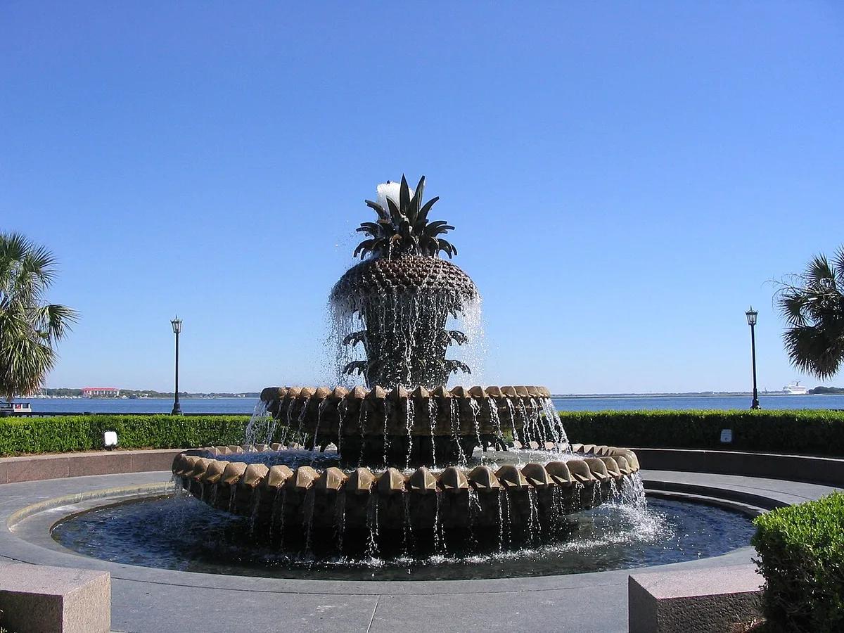
Pineapple Fountain in Charleston Waterfront Park
Pineapple Fountain at Waterfront Park
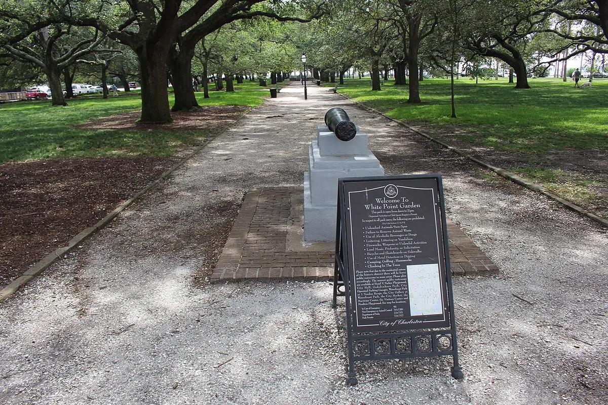
Tree lined entrance to White Point Garden near the Battery
White Point Garden
Arthur Ravenel Jr. Bridge over the Cooper River
Arthur Ravenel Jr. Bridge
Buildings along King Street in Charleston
King Street
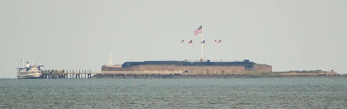
Fort Sumter across Charleston Harbor, seen from the Battery
Fort Sumter from the Battery
Photo credits

Where to stay in Charleston

  • Historic District and City Market

    • First visits
    • Walking
    • Historic sights
    • Harbor trips

    The City Market, French Quarter and Waterfront Park are a few minutes apart on foot. It is the place to be for an early Fort Sumter ferry or an evening stroll along East Bay Street. The narrow streets get crowded, and parking can be expensive.

    Around here: Charleston City Market, Waterfront Park, French Quarter

  • South of Broad and the Battery

    • Historic houses
    • Quiet walks
    • Harbor views

    Rainbow Row and the Battery line the southern end of the peninsula, with White Point Garden at its tip. Pick a room here for quiet residential streets and harbor walks. Shops and the main dining strip on Upper King are farther north.

    Around here: Rainbow Row, The Battery, White Point Garden

  • Upper King and Marion Square

    • Restaurants
    • Nightlife
    • Downtown access

    King Street north of Calhoun is the restaurant and bar strip, with Marion Square and the Visitor Center nearby. Stay here if dinner and nightlife matter more than waking up by the harbor. The Battery is a long walk south.

    Around here: Upper King Street, Marion Square, Charleston Visitor Center

  • Mount Pleasant and Shem Creek

    • Car trips
    • Shem Creek dining
    • Patriots Point

    Across the Ravenel Bridge, Mount Pleasant has the Shem Creek restaurants and Patriots Point. The USS Yorktown and the roads to the beaches are on this side of the river. For sightseeing on the peninsula, you will drive or take rideshares.

    Around here: Shem Creek, Patriots Point, Arthur Ravenel Jr. Bridge

  • West Ashley

    • Road trips
    • Parking
    • Longer stays

    West of the Ashley River you get more chain hotels and a head start on the Ashley River historic sites. The peninsula is a drive away. A lower rate here has to cover the traffic and the downtown parking.

    Around here: Ashley River Road, Charles Towne Landing, Ashley River

Best time to visit Charleston

Walking is most comfortable from March through May and again in October and November. June through September is the rainiest stretch, and summer afternoons are humid and hot. Winter is mild, though evenings can turn cool.

Average high and low (°F)Days with rainDrier months
  1. Jan: average high 60 °F, low 39 °F, 8.9 days with rain. Mild winter
  2. Feb: average high 64 °F, low 42 °F, 8.5 days with rain. Cool mornings
  3. Mar: average high 70 °F, low 47 °F, 8.2 days with rain. Spring walks
  4. Apr: average high 77 °F, low 55 °F, 7.9 days with rain. Warm spring
  5. May: average high 84 °F, low 63 °F, 8.1 days with rain. Warmer afternoons
  6. Jun: average high 89 °F, low 70 °F, 12.1 days with rain. Humid and wet
  7. Jul: average high 91 °F, low 74 °F, 13.2 days with rain. Hot and wet
  8. Aug: average high 90 °F, low 73 °F, 13.1 days with rain. Hot and wet
  9. Sep: average high 85 °F, low 68 °F, 10.2 days with rain. Hurricane season
  10. Oct: average high 78 °F, low 58 °F, 7.3 days with rain. Milder afternoons
  11. Nov: average high 69 °F, low 47 °F, 6.9 days with rain. Cooler walks
  12. Dec: average high 63 °F, low 42 °F, 9.3 days with rain. Mild winter
Source: Wikipedia: Charleston, South Carolina (Charleston International Airport 1991–2020 NOAA normals)

Getting to Charleston

Charleston International Airport (CHS) is in North Charleston, about 12 miles northwest of historic downtown. By car or taxi, take I-26 to the peninsula. CARTA buses run there too. Once you are downtown, walk.

CHSCharleston International Airport

12 mi from downtown

To Historic District
Depends on traffic. Take I-26 toward downtown
To Mount Pleasant
Depends on traffic. Take I-526 or the Ravenel Bridge route

You can take a taxi, a rideshare or a rental car from the terminal. CARTA buses also go downtown from the airport, but they take longer than driving.

Other ways to arrive

Car
I-26 ends near downtown, and U.S. 17 crosses the Ravenel Bridge to Mount Pleasant. Check what your hotel charges for parking before you drive onto the peninsula.
Bus
CARTA buses run to the airport and downtown. Free DASH shuttles loop around the historic peninsula.
Train
Amtrak stops in North Charleston, a drive from the historic peninsula.

Questions about Charleston

Where should I look if the Historic District is full?

Try Upper King first if you want downtown evenings. With a car, Mount Pleasant is next. The airport area makes sense for a late arrival.

Is an airport hotel good for a quick Charleston visit?

Only if your flight times matter more than the sightseeing. CHS is in North Charleston, about 12 miles from the historic peninsula.

Can I still book near Fort Sumter at short notice?

Maybe. Look around Liberty Square, the City Market and Upper King, then book your ferry separately.

Get more with App

Get real time price drop alerts, faster results and personalised experience along with exclusive deals.

App preview
Hotels70